Core Solutions

NEIMS (Network Configuration & Inventory Management System) is an integrated solution
for network configuration and asset management required by public institutions and smart cities with private communication networks.

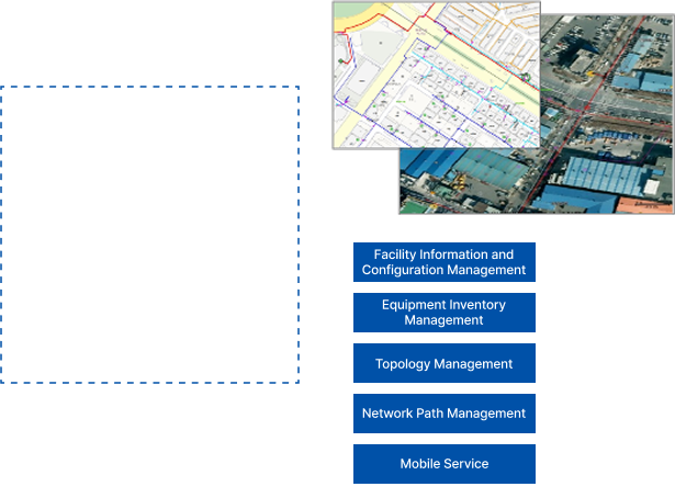
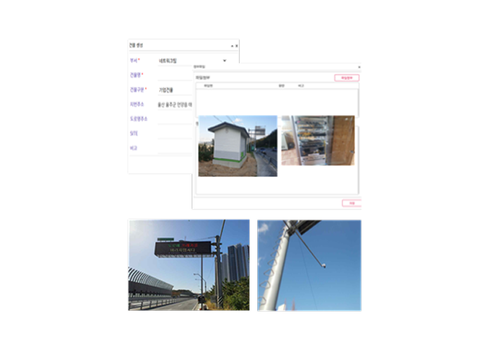
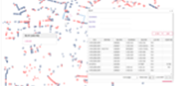
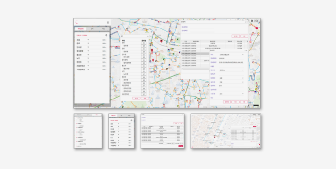
NEIMS registers network equipment and field facilities (such as optical cables, junction boxes, utility poles and power lines, communication poles, conduits, manholes, and handholes) that form a communication network in a GIS-based system, enabling a visual overview of facility status and detailed information. It also supports comprehensive and easy maintenance of communication networks.
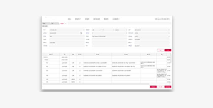
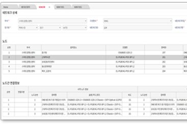
Port connection and line assignment configuration – Equipment/Facility Management
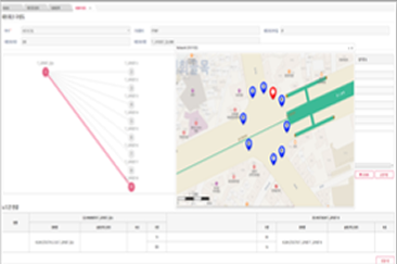
Installation location configuration and path generation – End-to-End Path Management
Node connection configuration for each service network – Circuit Management
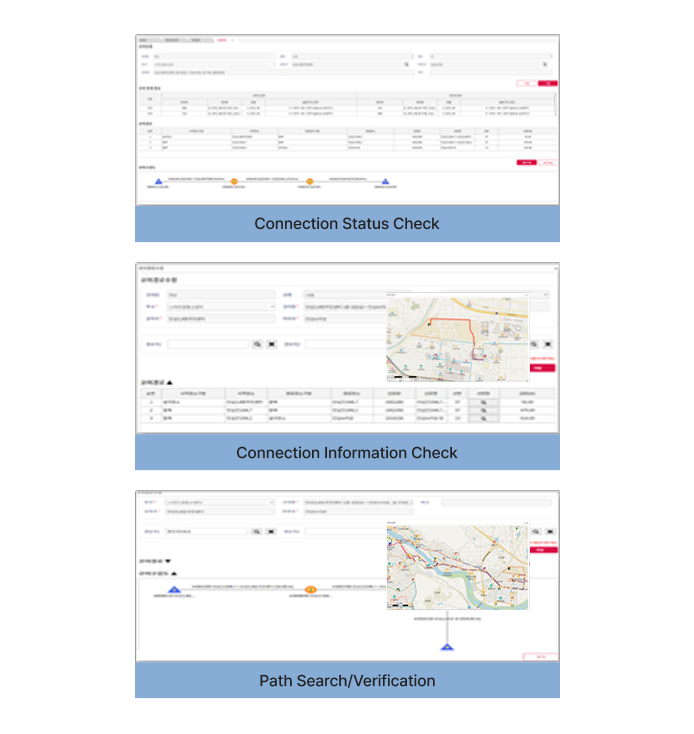
Network Management – Node sequencing and node-to-node connection
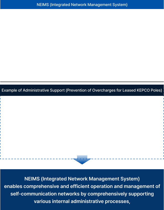
It enables easy maintenance and management of various private communication networks, including administrative networks and ITS private networks, which are utilized by various end-users (local governments, smart cities, industrial complexes, universities, and institutions).
Furthermore, it goes beyond conventional private network management by comprehensively supporting various interlinked operations to enhance operational efficiency.
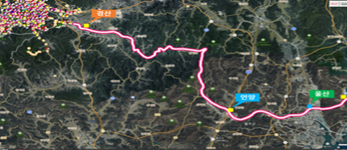
ITS Private Communication Network
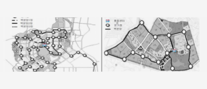
New Towns and Residential Development Areas
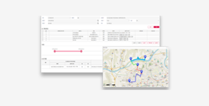
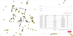
Efficient Line Management through Various Display Options

Efficient Line Management through Various Display Options
 Equipment Model
 Equipment Details
 Card Information
 Junction Box
 Handhole
 Optical Cable
 Utility Pole/Power Line
 Communication Pole
 Installation Location
 Line Assignment
 Conduit
Customized Integrated GIS-Based Environment
Direct Design/Management of Map Communication Network Components
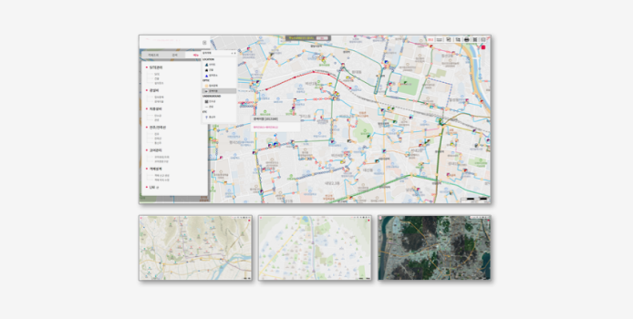
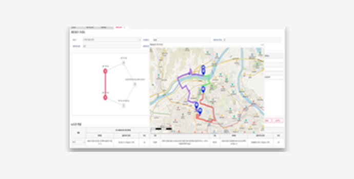
Network Configuration and Node-to-Node Topology Connection
 RING
RING
 PTP
PTP
 PTMP
PTMP
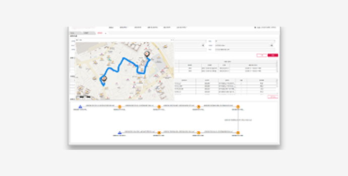
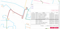
End-to-End Path Configuration and Management
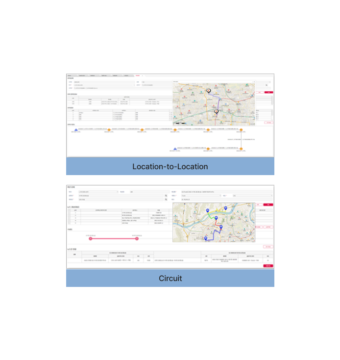
Automatic Search and Creation of Connection Paths Between Locations

NMS* is software that primarily monitors and manages network equipment, while the Optical Line Monitoring System is software that mainly monitors the status of optical cables in real time. It uses the measuring function of OTDR* to identify the loss, disconnection points, and distance of optical lines.
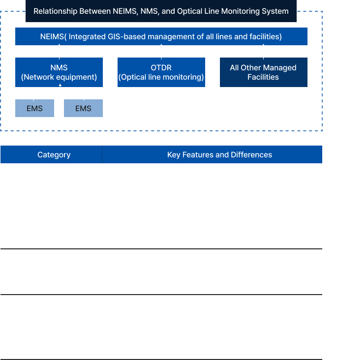
* NMS (Network Management System): Network management system
* OTDR (Optical Time-Domain Reflectometer): Optical fiber tester, optical pulse tester
* EMS (Element Management System)
Copyrightⓒwiseinfotech. all right reserved.


The company informs customers through the Privacy Policy about how the personal information provided is used and what measures are taken to protect personal information.
- Identifying individuals, verifying real names, confirming intent to sign up, and ensuring age-restricted service usage based on service use.
- Fulfilling contracts related to service provision, such as billing for services provided, delivering content, purchasing and processing payments, and dispatching items or billing statements.
- Delivering notices, ensuring communication for handling complaints, and ensuring accurate delivery information for item shipments.
- Providing information on new services and offering personalized services.
- Facilitating smooth provision of high-quality services.
- Name, company name, email, address, contact number, mobile phone number, inquiry details, and other optional items.
- As a general rule, personal information is destroyed immediately once the purpose for its collection or provision has been fulfilled.
- However, for the purpose of ensuring smooth service consultations, the content of the consultation may be retained for 3 months after completion. In cases where other laws, such as the Act on the Consumer Protection in Electronic Commerce, require preservation, the information may be retained for a specified period.
The company, as a general rule, destroys personal information without delay after the purpose of collection and use has been fulfilled. Information entered for membership or other purposes is transferred to a separate database (or, in the case of paper records, to a separate file) and stored for a certain period according to internal policies and relevant laws before being destroyed. Personal information transferred to a separate database is not used for any other purpose unless required by law. Personal information stored in electronic file formats is deleted using technical methods that prevent the recovery of the records.
The collection of email addresses posted on this website using email collection programs or other technical devices is prohibited, and violators may be punished under the Act on Promotion of Information and Communications Network Utilization and Information Protection.
